i90 PRO IMU-RTK GNSS

MULTI-CONSTELLATION TRACKING
Powered by a 336-channel GNSS core engine, the i90 Pro provides robust and reliable RTK position to any surveying project and positioning application.
L-BAND PPP CORRECTIONS
Connected to 3rd party L-Band corrections services, the i90 Pro GNSS provides accurate, sub-decimeter positioning in virtually all regions where RTK networks, GSM coverage or traditional GNSS base station are not available.
EXTENDED CONNECTIVITY
The i90 Pro GNSS combines high-end connectivity modules: Bluetooth, Wi-Fi, NFC, 4G, and UHF radio modem. The 4G modem brings ease of use when working within RTK networks. The internal UHF radio modem allows long-distance base-to-rover surveying up to 5 km
HIGH ACCURACY. ANYWHERE
The i90 GNSS build-in IMU ensures interference-free and automatic pole-tilt compensation in real-time. 3 cm accuracy is achieved with pole-tilt range of up to 30 degrees.
i90 IMU-RTK GNSS
FULL GNSS POSITIONING
The embedded 624-channel GNSS technology takes benefit from all GPS, GLONASS, Galileo and BeiDou signals and provides robust RTK position availability and reliability.
HASSLE-FREE IMU-RTK SURVEYING
No complicated calibration process, rotation, leveling or accessories are necessary with the i90. Just a few meters walk will initialize the i90 internal IMU module and enable RTK survey in difficult field environment.
EXTENDED CONNECTIVITY
The i90 GNSS combines high-end connectivity modules: Bluetooth, Wi-Fi, NFC, 4G, and UHF radio modem. The 4G modem brings ease of use when working within RTK networks. The internal UHF radio modem allows long-distance base-to-rover surveying up to 5 km.
HIGH ACCURACY. ALWAYS
The i90 GNSS build-in IMU ensures interference-free and automatic pole-tilt compensation in real-time. 3 cm accuracy is achieved with pole-tilt range of up to 30 degrees.
i80 GNSS

FULL GNSS FOR HIGH PRODUCTIVITY
Powered by a 220-channel GNSS core engine, the i80 GNSS provides reliable centimeter survey-grade accuracy to any demanding project.
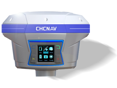
EASY CONFIGURATION AT YOUR FINGERTIPS
The 128 x 64 dpi LCD display gives entire control to the i80 GNSS. Whatever your survey requirements, the various work survey modes -UHF, NTRIP, GNSS data recording can be activated directly in the field.
UNINTERRUPTED OPERATION
Dual hot-swappable batteries allow extended full day fieldwork when connected to RTK network services. You can concentrate on your land surveying or topographic project without caring about power drop.
RUGGED TECHNOLOGY
Meeting the stringent IP68 standard to withstand the most demanding environmental conditions, the i80 GNSS cast magnesium chassis secures your investment. It can pair with your preferred 3rd party software seamlessly via a simple configuration web interface.
i70 GNSS

MULTI-CONSTELLATION
Powered by a 220-channel GNSS core engine, the i70 GNSS provides survey-grade accuracy to any surveying and construction project.
EASY CONFIGURATION AT YOUR FINGERTIPS
The 128 x 64 dpi LCD display gives entire control to the i80 GNSS. Whatever your survey requirements, the various work survey modes -UHF, NTRIP, GNSS data recording can be activated directly in the field.
EXTENDED INTERNET CONNECTIVITY
The i70 GNSS network modem is not only limited to the reception of RTK corrections but can be turned into a Wi-Fi hotspot. It provides internet access to your controller and enable transfer of your jobs back and forth between field and office.
INTEGRATED UHF RADIO FOR MORE PRODUCTIVITY
The enhanced internal UHF radio can be tuned from 410 MHz to 470 MHz and provides up to 5 km coverage. Your topographic project is achieved faster without the need to relocate your base station.
i50 GNSS

FULL-CONSTELLATION
The embedded 624-channel GNSS technology enhances reliability and performance to ensure accurate measurements. It allows for fast signals tracking and quick RTK fixed solution to improve productivity and reduce survey time in the field.
VERSATILE WORK MODES FOR BETTER FLEXIBILITY
May your project conditions change during your project, the preset survey modes are easy to select or switch directly on the i50 GNSS receiver. Your favorite RTK survey modes is always saved and start automatically when the receiver starts saving unnecessary set up time.
RUGGED AND COMPACT
The i50 GNSS rugged industrial design guarantees its RTK performances in harsh environment and adverse weather conditions. Downtime or environmental limitations virtually no longer exist.
UNINTERRUPTED OPERATION
Dual hot-swappable batteries allow extended full day fieldwork when connected to RTK network services. You can concentrate on your mission without caring about power drop.
M6 GNSS

Easy-to-use GNSS NTRIP Network RTK receiver optimized for topographic and construction survey projects
High performance survey-grade 220 channels GNSS core with GPS, Glonass, Galileo, BeiDou and SBAS
Extremely compact and lightweight - less than 1 kg - for all day long intensive fieldwork
Embeded configuration web interface to connect seamlessly with your preferred 3rd party software