Static Data Download
This facility allows a registered user to download 5 seconds interval RINEX 2.3 raw data from all our CORS stations.
This implies that a land Surveyor/ Geomatician or Topographical Engineer can establish and extend controls points throughout the country without searching/ locating physical controls/monuments in his project area. This saves a lot of resources both time and money.
This is made possible by user friendly interface under the REREFENCE DATA SHOP.
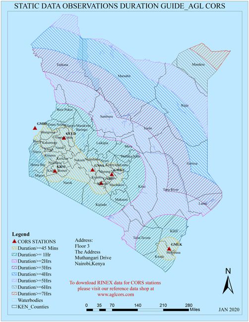
Above is an image of a proposed static data observation guide when using Agl CORS stations as your controls
Prices
Agl decided to avail this service for free to the registered users this year 2020 as we educate and promote it among the Kenyan geospatial community and the general public. We do reserve the rights to change this status quo without notice.